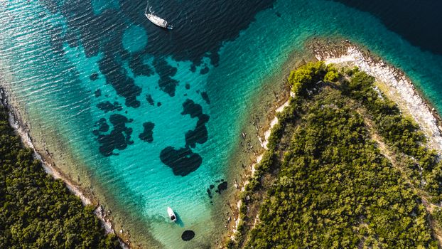
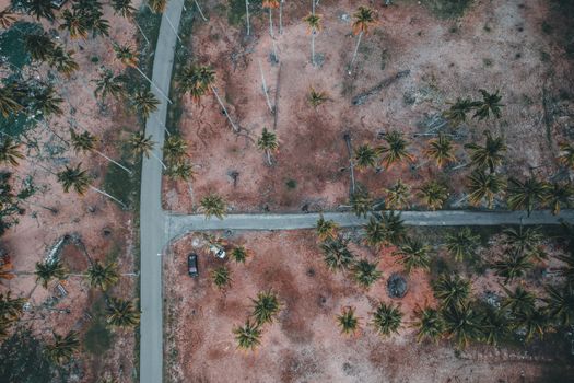
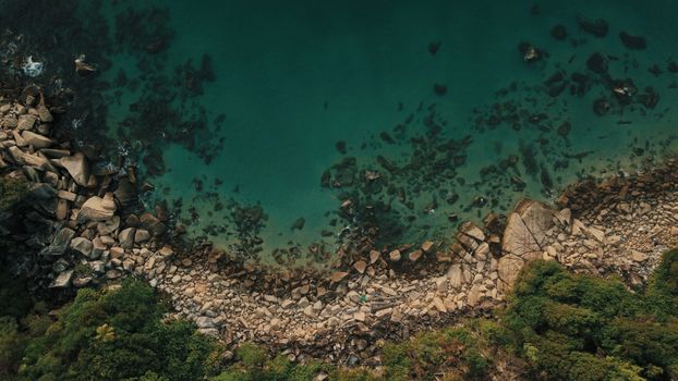
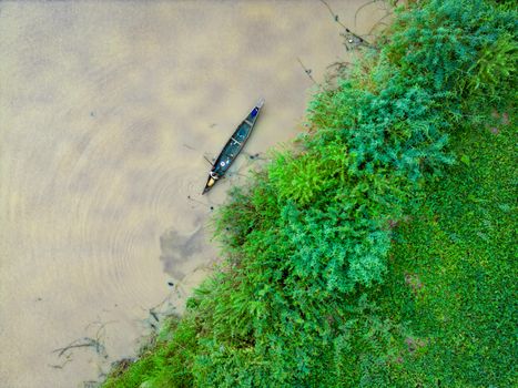
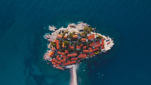
Remember that gut-wrenching feeling? I was standing on a cliff edge in a remote corner of Southeast Asia, my brand-new drone humming impatiently in its case. Below me, an emerald bay sparkled, framed by towering limestone karsts. It was the shot, the one I’d dreamed of for months. But then, a local guide gently pointed to a faded, hand-drawn sign: "No Drone Zone. Strict Enforcement." My heart sank faster than a poorly piloted quadcopter.
That experience taught me a crucial lesson: finding incredible drone photography locations is only half the battle. The other, equally vital half? Ensuring you can legally and responsibly fly there. The world of drone regulations is a labyrinth, constantly changing, and a single misstep can lead to hefty fines, drone confiscation, or worse, damaging local relations.
But don't despair! The thrill of seeing the world from a bird's-eye view, capturing those impossible perspectives, is absolutely worth the effort. And trust me, there are still countless places where your drone can truly soar.
After years of meticulous research, countless permit applications, and a fair share of trial and error (and thankfully, no drone confiscations!), I’ve curated a list of trending, jaw-dropping drone photography locations where flying is not just allowed, but often encouraged – provided you follow the rules. These aren't just pretty places; these are destinations where the aerial perspective unlocks a whole new level of magic.
Ready to elevate your travel photography? Let's take flight!
1. The Crimson Sands & Sapphire Lakes: Al Qudra Desert, Dubai, UAE
Why it's Trending:
While Dubai's urban sprawl is heavily restricted for drones, just a short drive out into the desert reveals a different world. Al Qudra Lakes, a series of man-made oases, has become a trending spot for its dramatic desert landscapes, shimmering waters, and surprisingly abundant wildlife (hello, Arabian Oryx!). The contrast between the golden dunes and the turquoise lakes, especially at sunrise or sunset, is pure aerial gold. It offers a sense of vastness and solitude rarely found so close to a bustling metropolis.
My Experience:
My first attempt to fly my drone near the Burj Khalifa was, predictably, a non-starter. But a local photographer friend tipped me off about Al Qudra. The drive out there felt like entering another dimension. As the sun dipped, painting the sky in fiery oranges and purples, I launched my Mavic. Below me, the intricate patterns of the dunes stretched endlessly, meeting the glassy surface of the lakes where flamingos often gather. I spotted a herd of oryx gracefully moving across the sand – a truly unforgettable moment to capture from above. The sheer freedom of flying in such an open, majestic space after the urban restrictions was incredibly liberating.
Practical Tips:
* Regulations: Recreational drone flying in designated areas like Al Qudra is generally allowed, but you must register your drone with the UAE's General Civil Aviation Authority (GCAA) before arrival. This is non-negotiable and easily done online.
* Best Time to Fly: Golden hour (sunrise and sunset) is paramount here. The light transforms the dunes into a photographer's dream. Midday sun can be harsh and flatten the landscape.
* Wildlife: Be incredibly mindful of the wildlife, especially the Arabian Oryx. Maintain a respectful distance and avoid disturbing them. Fly high enough to not cause distress.
* Wind: The desert can get surprisingly windy, especially in the afternoon. Check forecasts before you go.
* Location Specifics: Focus on the Qudra Lakes area, particularly around Love Lake or the Flamingo Lake. Ensure you are well away from any restricted zones, which are clearly marked on drone apps like AirMap.
2. Nordic Drama & Fishermen's Huts: Lofoten Islands, Norway
Why it's Trending:
The Lofoten Islands are a perennial favorite for photographers, but drone technology has unlocked new perspectives on its dramatic fjords, jagged peaks, and iconic red "rorbuer" (fishing huts) dotting the coastline. From above, the sheer scale of the landscape, the turquoise waters, and the winding roads become even more breathtaking. It's a place where every aerial shot looks like a postcard.
My Experience:
I visited Lofoten in late autumn, and the weather was, shall we say, "character-building." One morning, after battling relentless rain and biting winds for days, the clouds finally broke. I hiked up to a viewpoint near Reine, my fingers numb, but my excitement buzzing. Launching my drone, I watched as it ascended, revealing the iconic village nestled amongst towering, snow-dusted mountains, reflected perfectly in the calm fjord below. The vibrant red huts popped against the muted greens and grays. It was a shot I’d envisioned for years, and the drone made it possible to capture the entire scene in one epic frame, something no ground-based camera could achieve. The cold meant my battery life was shorter than usual, adding a layer of urgency to every flight.
Practical Tips:
* Regulations: Norway has generally drone-friendly regulations for recreational pilots. You must stay below 120 meters (400 feet), maintain visual line of sight, and keep a safe distance from people, buildings, and airports. Always check local signs, especially near popular hiking trails or protected areas.
* Weather Challenges: Lofoten weather is notoriously unpredictable. Strong winds are common, and cold temperatures significantly reduce battery life. Bring extra batteries and keep them warm. Waterproof your gear as much as possible.
* Respect Local Life: Many villages are small and quiet. Be mindful of privacy and noise. Avoid flying directly over homes or disturbing residents.
* Iconic Shots: Reine, Hamnøy, Nusfjord, and Henningsvær offer incredible aerial opportunities. Look for the winding roads and bridges connecting the islands.
* Safety: The mountains are steep. Find safe, flat takeoff and landing spots away from sheer drops.
3. Limestone Karsts & Emerald Lagoons: Palawan, Philippines
Why it's Trending:
Palawan, often hailed as the "Last Frontier" of the Philippines, is experiencing a surge in drone tourism thanks to its unparalleled beauty. The aerial view of El Nido's Bacuit Bay, with its towering limestone formations jutting out of impossibly clear turquoise waters, hidden lagoons, and secret beaches, is simply mesmerizing. Drones allow you to truly appreciate the intricate geography and vibrant marine ecosystems from above.
My Experience:
Island hopping in El Nido was already an adventure, but adding a drone brought it to another level. Launching from the deck of our bangka (local boat) as we entered the Big Lagoon was a bit nerve-wracking, but the results were worth it. The drone ascended, revealing the narrow entrance to the lagoon, the kayaks paddling through, and the dramatic cliffs enclosing the serene waters. Later, I flew over a hidden beach, capturing the pristine white sand and the gentle waves breaking, completely untouched. The biggest challenge was keeping the drone safe from saltwater spray and sand, but the unique perspectives were irreplaceable.
Practical Tips:
* Regulations: The Philippines generally allows recreational drone flying, but you must register with the Civil Aviation Authority of the Philippines (CAAP) if your drone weighs over 7 kg (most consumer drones are below this). Stay below 120 meters and avoid restricted zones (airports, military bases). Local guides can often advise on specific area restrictions.
* Water & Sand Protection: Saltwater is a drone's worst enemy. Be extremely careful when launching from boats or near the shore. Use a landing pad. Clean your drone thoroughly after flying near the ocean.
* Respect Marine Life: Avoid flying low over coral reefs or disturbing marine animals.
* Battery Life in Heat: High temperatures can affect battery performance. Keep spare batteries charged and cool.
* Iconic Shots: El Nido's Bacuit Bay (Big Lagoon, Small Lagoon, Shimizu Island), Coron's Kayangan Lake (fly from higher ground for perspective), and the stunning sandbars.
4. Fairy Chimneys & Hot Air Balloons: Cappadocia, Turkey
Why it's Trending:
Cappadocia is a dream for any photographer, but with a drone, it transforms into an otherworldly spectacle. Imagine flying your drone amongst hundreds of hot air balloons rising with the sunrise over the unique "fairy chimney" rock formations. This ethereal experience, often shared widely on social media, has made Cappadocia a trending drone hotspot.
My Experience:
This was perhaps my most anticipated drone flight. Waking up at 4 AM, driving to a viewpoint, and watching the first balloons ignite their burners was magical enough. But then, as the sky began to lighten, I launched my drone. Slowly, carefully, I navigated it upward, trying to position it to capture the sheer scale of the balloon fleet against the rising sun and the surreal landscape. It was a delicate dance, respecting the balloonists' space and the wind conditions, but when I landed and reviewed the footage, I gasped. The drone had captured the iconic shot: a sea of colorful balloons floating above the ancient valleys, an aerial ballet unlike anything else on Earth. The key was patience and a very early start!
Practical Tips:
* Regulations: Turkey requires drone registration and adherence to general safety guidelines (staying below 120 meters, maintaining visual line of sight). The Turkish Directorate General of Civil Aviation (DGCA) website is your go-to. Be aware of no-fly zones, especially around airports.
* Balloon Etiquette: This is crucial. Maintain a safe and respectful distance from the hot air balloons. Do not fly directly above or below them, and never interfere with their flight path. The pilots are skilled, but unexpected drone movements can be dangerous.
* Timing: Sunrise is the time to fly. The light is perfect, and that's when the balloons are out. Plan to be set up and ready to launch well before the sun crests the horizon.
* Wind Conditions: Wind is a significant factor for both drones and hot air balloons. If it's too windy for balloons, it's likely too windy for your drone.
* Iconic Shots: Göreme, Love Valley, Pigeon Valley, and Ürgüp all offer incredible perspectives of the fairy chimneys.
5. Red Rock Grandeur & Desert Vistas: Moab, Utah, USA
Why it's Trending:
The American Southwest, with its vast, dramatic landscapes, offers unparalleled opportunities for drone photography. Moab, in particular, has seen a surge in popularity for its accessible red rock canyons, towering mesas, and iconic arches. While National Parks are strict "no drone zones," the surrounding Bureau of Land Management (BLM) lands and State Parks offer incredible, legal flying opportunities to capture the sheer scale and unique geology of the region.
My Experience:
After a day of hiking in Arches National Park (where I respectfully kept my drone packed away), I ventured to Dead Horse Point State Park, just outside Moab. The view from the mesa, overlooking the winding Colorado River carving through the canyon, was already breathtaking. But launching my drone allowed me to truly grasp the immense scale. I flew it out over the canyon, carefully maintaining line of sight, capturing the vibrant reds and oranges of the cliffs contrasting with the deep green of the river below. The drone revealed hidden crevices and layers of geological history that were invisible from the ground. It made me feel tiny in the best possible way.
Practical Tips:
* Regulations: In the USA, recreational drone pilots must follow FAA guidelines (The Recreational UAS Safety Test (TRUST) and marking your drone). National Parks are strictly off-limits for drone flying. However, many State Parks (like Dead Horse Point) and vast tracts of BLM land do allow flying. Always check specific park rules and BLM land use regulations. Use apps like B4UFLY.
* Heat & Battery Life: The desert sun can be intense. Keep your batteries cool and shaded when not in use. Overheating can damage them and reduce flight time.
* Wind & Dust: Wind can pick up quickly in the canyons. Be aware of sudden gusts. Fine desert dust can also be an issue, so ensure your drone is clean and free of debris.
* Respect the Landscape: These are fragile environments. Land and launch from designated areas or flat, open ground. Do not disturb rock formations or wildlife.
* Iconic Shots: Dead Horse Point State Park, Corona Arch (on BLM land), and the vast open spaces outside the National Parks. Research specific launch points carefully.
6. Volcanic Peaks & Lush Terraces: Bali, Indonesia (Mount Batur & Jatiluwih)
Why it's Trending:
Bali, a spiritual and natural paradise, offers stunning drone opportunities beyond its beaches. The dramatic volcanic landscapes, particularly around Mount Batur and Mount Agung, provide epic sunrise vistas. Combined with the intricate, emerald-green rice terraces of Jatiluwih (a UNESCO World Heritage site), drones unlock a unique perspective on Bali's diverse natural beauty and agricultural artistry.
My Experience:
The hike up Mount Batur for sunrise was challenging, but the aerial reward was immeasurable. As the first rays of light kissed the horizon, I launched my drone from a safe distance from the caldera rim. The drone climbed, revealing the steam rising from the active volcano, the blanket of clouds below, and the distant outline of Mount Agung. It felt like I was flying on the edge of the world. Later, flying over the Jatiluwih rice terraces was a completely different experience – a mosaic of greens, meticulously carved into the hillsides, showcasing centuries of agricultural wisdom. The drone allowed me to capture the intricate patterns and the sheer scale of the terraced landscape, a truly humbling sight.
Practical Tips:
* Regulations: Indonesia requires drone registration with the DGCA for drones over 250 grams. There are strict no-fly zones around airports (Denpasar) and specific government/military installations. Always confirm local regulations, especially near sacred sites.
* Respect Sacred Sites: Bali is deeply spiritual. Never fly over temples or sacred ceremonies. Maintain a respectful distance and be mindful of local customs.
* Weather & Clouds: Volcanic areas can have unpredictable weather, with clouds rolling in quickly. Plan for early morning flights for the best visibility.
* Battery Life in Humidity: High humidity and heat can affect battery performance. Store batteries properly.
* Local Guides: Hiring a local guide, especially for volcano treks, can provide invaluable insight into safe and permissible drone zones.
* Iconic Shots: Sunrise over Mount Batur, the vastness of the Jatiluwih rice terraces, and coastal views away from crowded beaches.
Elevate Your Shots Responsibly: General Drone Flying Tips
Before you pack your bags and launch your drone, remember that responsible flying is paramount. These tips will help you capture incredible footage while respecting local communities, wildlife, and regulations:
- Know Before You Go (Seriously!): Research local drone laws before you travel. Websites of national aviation authorities (e.g., FAA in the US, GCAA in UAE, CAAP in the Philippines) are crucial. Apps like AirMap or B4UFLY are excellent resources for checking local no-fly zones.
- Permits & Registration: If required, apply for permits and register your drone well in advance. Don't skip this; fines and confiscations are real.
- Maintain Visual Line of Sight (VLOS): Always keep your drone within your direct line of sight. This is a common regulation globally.
- Respect Privacy: Avoid flying over private property without permission, and never intentionally film people without their consent.
- Protect Wildlife: Maintain a safe distance from animals. Never harass or chase wildlife with your drone.
- Weather is Key: Always check wind speeds, rain forecasts, and temperature. Extreme conditions can damage your drone or make flying unsafe.
- Battery Management: Bring extra batteries. Cold weather drastically reduces battery life, while extreme heat can also impact performance. Keep batteries charged and at optimal temperatures.
- Gear Protection: Invest in a good drone bag. If flying near water or sand, use a landing pad. Clean your drone regularly, especially after flying in dusty or salty environments.
- Insurance: Consider drone insurance. Accidents happen, and it's better to be prepared.
- Backup Your Footage: Always backup your precious aerial memories!
The Sky's the Limit (Legally, Of Course!)
Drone photography has utterly transformed travel content, offering perspectives that were once reserved for Hollywood blockbusters. The ability to capture the sweeping grandeur of a landscape, the intricate patterns of nature, or the vibrant pulse of a remote village from above is truly a gift. But with great power comes great responsibility.
By choosing trending, legal locations and adhering to ethical flying practices, you're not just creating stunning content; you're also being a responsible ambassador for the drone community. So, register your drone, pack your extra batteries, and get ready to see the world in a way you never thought possible.
Where will your drone take you next? What's your dream drone photography location? Share your thoughts and experiences in the comments below! Let's inspire each other to explore the world from new heights!
---