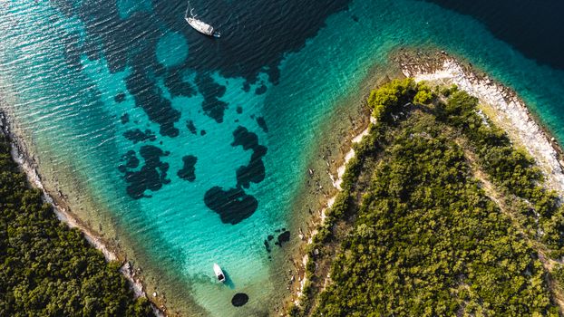
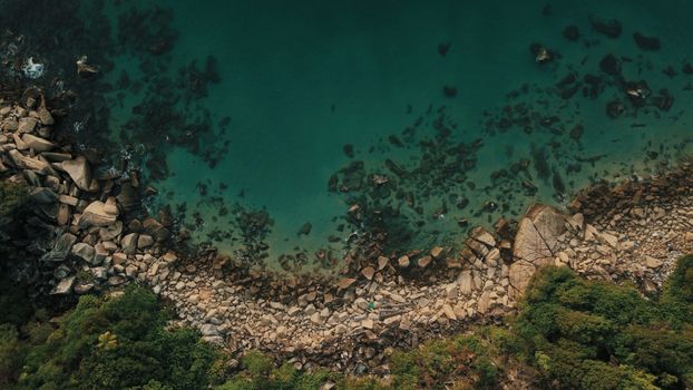
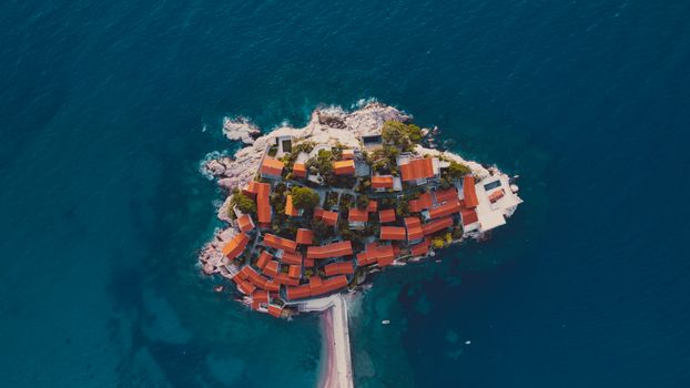
The wind whipped around me, threatening to snatch my drone right out of the sky. Below, the turquoise waters of Jökulsárlón Glacier Lagoon stretched out, dotted with luminous icebergs, some as big as houses. My fingers, numb despite my gloves, hovered over the controls, my eyes glued to the screen showing a perspective no human could ever see from the ground. Then, the perfect shot: a lone iceberg, perfectly framed against the dark volcanic sand and the distant, snow-capped peaks. That moment, that unique viewpoint, that feeling of capturing something truly extraordinary – that’s the magic of drone photography.
It was also a stark reminder of the challenges: the weather, the regulations, the sheer responsibility. As a travel blogger for Tripsora, I've crisscrossed the globe, always with my trusty drone in tow. I’ve learned the hard way that not all incredible places welcome flying, and navigating the ever-changing rules can be a minefield. But when you find those sweet spots, those breathtaking locations where you can legally and safely launch your drone, the results are simply unparalleled.
This isn't just a list; it's a bucket list. These are the places that have taken my breath away, the ones that have filled my memory cards with images I still can't quite believe I captured. These are the drone photography locations that allow flying you need to experience before you die. So, charge your batteries, pack your filters, and prepare for an aerial adventure!
---
1. Iceland's Glacial Grandeur: Where Ice Meets Volcanic Sand
Iceland. Just the name conjures images of raw, untamed beauty. And from above, it’s even more spectacular. My first trip to Iceland was a revelation, but it was my drone that truly unlocked its secrets. The country is generally quite drone-friendly, though you must always respect national park restrictions, private property, and obvious no-fly zones (like near airports or populated areas).
Where to Fly:
* Jökulsárlón Glacier Lagoon & Diamond Beach: This is hands-down my top recommendation. Picture this: ancient icebergs, calved from a massive glacier, floating serenely in a lagoon before drifting out to sea and washing ashore on a black sand beach. From above, the patterns of the ice, the contrast of blue and black, and the sheer scale are mesmerizing. I remember battling a fierce wind here, my Mavic 3 Pro fighting to stay steady, but the resulting shots of the icebergs shimmering like diamonds were worth every nerve-wracking moment.
* Reynisfjara Black Sand Beach: Near Vík, the basalt columns and dramatic sea stacks (Reynisdrangar) look incredible from an aerial perspective, especially at sunrise or sunset. The waves here are powerful, so maintain a safe distance from the water.
* Fjadrargljufur Canyon: This winding, moss-covered canyon is a dream. While there are viewing platforms, flying above reveals its true serpentine beauty and depth. Check for temporary restrictions, as popular spots sometimes implement them for conservation.
Practical Tips for Iceland:
* Wind is your enemy (and friend): Iceland is notoriously windy. Check forecasts meticulously. Always fly with plenty of battery life, as strong winds drain it faster.
* Cold Batteries: Batteries lose efficiency in the cold. Keep them warm in an inside pocket until just before launch.
* Respect the Landscape: Stick to designated paths and avoid disturbing wildlife, especially nesting birds.
* Cost: Flying itself is free, but general travel costs in Iceland are high (accommodations, car rental, tours). Budget around $150-$300/day for a mid-range trip.
---
2. Wadi Rum, Jordan: Martian Landscapes & Ancient Sands
When I first saw Wadi Rum from my drone screen, I gasped. It felt like I’d been transported to Mars. The vast, silent desert, with its towering sandstone mountains and rich red dunes, is a playground for aerial photography. While flying directly over sensitive historical sites like Petra often requires special, hard-to-get permits (and is generally discouraged for tourists), Wadi Rum offers equally stunning, and much more accessible, drone opportunities.
Where to Fly:
* Wadi Rum Protected Area: This UNESCO World Heritage site is a sprawling expanse of desert beauty. From above, the intricate patterns of the dunes, the dramatic shadows cast by the jabal (mountains), and the occasional Bedouin camp become works of art. My most memorable flight here was at sunrise, capturing the first golden light hitting the red sands, with a line of camels trekking slowly across the vastness below. The silence, broken only by the drone’s hum, was profound.
* Bedouin Camps: With permission, flying around a Bedouin camp can offer incredible cultural shots – the tents, the camels, the daily life against an epic backdrop. Always ask first!
Practical Tips for Wadi Rum:
* Sand & Dust: The desert is harsh on electronics. Be extremely careful when launching and landing. Consider a portable landing pad.
* Heat: Drones can overheat. Avoid flying during the hottest parts of the day.
* Respect Local Culture: Jordan is a conservative country. Be mindful of privacy and local customs.
* Guides: Hiring a local Bedouin guide for your desert adventure is essential and they can often advise on good flying spots and local sensitivities.
* Cost: A guided jeep tour into Wadi Rum typically costs $50-$100 per person, often including a meal. Accommodation in a desert camp ranges from $30-$200+.
---
3. Patagonian Panoramas: El Chaltén & Beyond (Argentina)
Patagonia is a land of extremes, and its raw, untamed beauty is best appreciated from above. While many national parks (like Torres del Paine in Chile) have strict drone prohibitions, the Argentinian side, particularly around El Chaltén, offers incredible opportunities, provided you stay outside strictly protected areas and respect local guidelines.
Where to Fly:
* El Chaltén Area (Mount Fitz Roy & Cerro Torre): The "Trekking Capital of Argentina" is surrounded by some of the most iconic peaks in the world. While you can't fly within Los Glaciares National Park (which encompasses the main trails), many areas just outside the park boundaries offer stunning vistas of Fitz Roy and Cerro Torre. From the air, the jagged peaks, the turquoise glacial lakes, and the vast Patagonian steppe create a truly epic tableau. I once managed to capture a stunning timelaps of clouds swirling around Fitz Roy’s summit from a permitted spot just outside the park, a memory I’ll never forget.
* Ruta 40 (Southern Section): As you drive through Patagonia, the vastness of the steppe, the braided rivers, and the occasional guanaco herd make for compelling aerial footage. Always pull over safely and ensure no private property is being violated.
Practical Tips for Patagonia:
* Extreme Winds: Patagonia is infamous for its powerful winds. Seriously, check the wind speed and direction constantly. My drone has been pushed to its limits here.
* Battery Life in Cold: Similar to Iceland, cold temperatures will reduce battery performance. Keep them warm.
* Research Park Boundaries: This is critical. Use apps like AirMap and cross-reference with local park ranger information. Ignorance is not an excuse.
* Cost: Trekking around El Chaltén is generally free. Accommodation can range from $40 (hostel) to $200+ (hotel). Food is reasonably priced.
---
4. Fairytale Islands: The Faroe Islands' Dramatic Cliffs
The Faroe Islands feel like they were plucked from a fantasy novel. Green, windswept, and dotted with sheep, these remote islands in the North Atlantic are a drone pilot’s dream. The regulations are generally quite accommodating for tourists, though local signs and respect for wildlife (especially nesting birds) are paramount.
Where to Fly:
* Gásadalur (Múlafossur Waterfall): This iconic waterfall, plunging directly into the ocean, is even more spectacular from above. You can get incredible shots of the village, the sheer cliffs, and the dramatic coastline. My first time flying here, the wind was so strong I almost chickened out, but I carefully launched my drone, and the resulting shot of Múlafossur framed by the rugged cliffs became one of my most shared images.
* Drangarnir & Tindhólmur: These incredible sea stacks and islets off Vágar Island are breathtaking from an aerial perspective. You’ll need to hike or take a boat to get close enough for a good launch, but the views of the natural arch and the jagged peaks are worth the effort.
* Saksun: The picturesque village of Saksun, nestled in a natural amphitheater, with its turf-roofed houses and tidal lagoon, offers unique compositional opportunities from above.
Practical Tips for the Faroe Islands:
* Rapid Weather Changes: The weather here can change in minutes. Be prepared for sun, rain, and strong winds, sometimes all in one flight.
* Respect Wildlife: The islands are home to vast bird colonies. Avoid flying too close to birds or their nesting sites.
* Local Farm Land: Many stunning locations are on private farmland. Always be respectful, close gates, and if in doubt, ask.
* Cost: Accommodation can be pricey ($100-$300/night). Car rental is essential ($50-$100/day). Flights to the Faroes can be expensive.
---
5. New Zealand's Aerial Playground: Lakes & Mountains
New Zealand, the "Land of the Long White Cloud," is a visual masterpiece from any angle, but especially from the air. Its diverse landscapes – from snow-capped mountains to turquoise lakes and braided rivers – offer endless drone opportunities. While the Department of Conservation (DOC) manages vast tracts of land with strict drone rules, many stunning areas remain accessible.
Where to Fly:
* Lake Tekapo & Church of the Good Shepherd: During late spring/early summer, when the lupins are in bloom, Lake Tekapo is a riot of color. Flying over the iconic church with the turquoise lake and purple flowers stretching into the distance is like something out of a dream. I recall spending an entire morning here, capturing the different patterns of the lupins and the lake's incredible hue.
* Queenstown & Lake Wakatipu: The adventure capital offers incredible surrounding landscapes. While flying directly over the town center is restricted, the mountainsides and surrounding areas of Lake Wakatipu provide panoramic views of the Remarkables mountain range and the serpentine lake.
* Glenorchy: Known as "Middle-earth," the area around Glenorchy is stunning. The braided Dart River, the ancient forests, and the dramatic mountains are perfect for cinematic aerial shots. Always check for specific local regulations, especially near walking tracks.
Practical Tips for New Zealand:
* DOC Regulations: This is the big one. Always check the DOC website for specific rules regarding drone use in national parks and conservation areas. Many are no-fly zones without a special permit.
* Wind in Mountains: Mountainous regions can have unpredictable updrafts and downdrafts. Fly with caution.
* Respect Privacy: Kiwis value their privacy. Avoid flying over residential areas or private property without permission.
* Cost: New Zealand can be expensive, especially for tours and activities. Accommodation varies ($50-$300+). Car rental is highly recommended.
---
6. Australia's Coastal Canvas: Whitsunday Islands
Australia offers some of the most spectacular coastlines on Earth, and the Whitsunday Islands are a jewel in its crown. While the Great Barrier Reef Marine Park has very strict drone regulations (often requiring permits that are difficult for tourists to obtain), the Whitsundays offer a fantastic alternative for capturing stunning aerials of white sand and turquoise water.
Where to Fly:
* Whitehaven Beach & Hill Inlet: This is the quintessential Whitsundays drone shot. The swirling sands of Hill Inlet, where the pure white silica sand meets the vibrant blue and green waters, create an ever-changing masterpiece. From a high vantage point, the patterns are simply breathtaking. I remember the sheer joy of seeing those iconic swirls unfold on my screen, capturing the perfect moment as the tide shifted.
* Other Whitsunday Islands: Many of the smaller, uninhabited islands offer incredible opportunities for capturing pristine beaches, clear waters, and lush vegetation. Always check with local tour operators or island management for specific rules.
Practical Tips for Australia:
* Marine Park Regulations: This cannot be stressed enough. Familiarize yourself with the Great Barrier Reef Marine Park zoning plan. Flying within the marine park is generally prohibited without a permit. Stick to coastal areas and islands where flying is explicitly allowed.
* Sun & Glare: The Australian sun is intense. Use ND filters to manage exposure and a sunshade for your phone/tablet screen.
* Saltwater & Sand: Be mindful of saltwater spray and fine sand, which can damage your drone.
* Cost: Whitsunday tours can range from $100-$300+ for day trips, up to $500-$1500 for multi-day sailing trips. Accommodation on the mainland (Airlie Beach) is more affordable than on the islands.
---
7. Arctic Archipelago: Lofoten Islands, Norway
The Lofoten Islands are a dramatic masterpiece, a collection of rugged peaks plunging into the Norwegian Sea, dotted with picturesque fishing villages and vibrant red rorbu cabins. In winter, the chance to capture the Northern Lights dancing over these landscapes from above is a truly once-in-a-lifetime experience. Norway generally has liberal drone laws, but local restrictions always apply.
Where to Fly:
* Reine & Hamnøy: These iconic fishing villages, with their red cabins nestled at the foot of towering mountains, are incredibly photogenic from the air. You can capture the entire village, the surrounding fjords, and the winding roads. My winter trip to Lofoten was particularly memorable; flying my drone over a snow-covered Hamnøy as the last rays of sun hit the mountains was pure magic.
* Nusfjord: Another beautifully preserved fishing village, Nusfjord offers unique compositions of traditional architecture against the dramatic natural backdrop.
* Haukland Beach & Uttakleiv Beach: These stunning white sand beaches, contrasting with the dark mountains and turquoise water, are fantastic for aerial landscape shots.
Practical Tips for Lofoten:
* Extreme Cold & Wind: Lofoten is in the Arctic Circle. Batteries drain extremely fast in cold weather. Keep them warm and carry spares. Winds can be ferocious, especially near the coast and mountains.
* Respect Privacy: While flying over villages, be mindful of people's homes and privacy.
* Check Local Signs: Despite generally liberal laws, specific areas, especially popular viewpoints or protected zones, may have no-drone signs. Always abide by them.
* Cost: Lofoten can be expensive, especially during peak season. Accommodation (rorbu cabins are popular) can range from $100-$400+. Car rental is essential.
---
Essential Drone Travel Tips for the Responsible Explorer
Beyond specific locations, there are universal rules for being a responsible and successful drone pilot:
- Research, Research, Research: Before every trip and every flight, check local, regional, and national drone laws. Use apps like AirMap, B4UFLY, and consult official government aviation websites. Laws change frequently!
- Permits & Permissions: Some countries or specific sites require permits. Always apply well in advance. For private land, always ask for permission.
- Weather is King: Wind, rain, fog, and extreme temperatures can all ground your drone or worse, lead to a crash. Never fly in conditions beyond your drone’s capabilities.
- Battery Management: Carry multiple batteries. Keep them warm in cold weather. Always leave yourself enough battery to return safely, accounting for wind.
- Respect Privacy & Wildlife: Never fly over people without their explicit consent. Maintain a safe distance from animals, especially birds, which can be aggressive or easily stressed.
- Insurance: Drone insurance (liability and accidental damage) is a wise investment, especially when traveling internationally.
- Maintenance & Pre-Flight Checks: Inspect your propellers, battery, and sensors before every flight. Ensure your firmware is up to date.
- Packing Essentials: Extra batteries, ND filters (crucial for video), a portable landing pad, cleaning cloths, and a power bank for your controller/phone.
---
Your Aerial Adventure Awaits!
The world is a vast, beautiful canvas, and with a drone, you gain an entirely new perspective – one that transforms familiar landscapes into extraordinary works of art. From the icy expanse of Iceland to the fiery sands of Jordan, the dramatic peaks of Patagonia to the fairytale cliffs of the Faroes, these locations are more than just places to fly; they're experiences that will stay with you long after your drone has landed.
Remember, the magic of drone photography comes with the responsibility of being a respectful, informed, and safe pilot. So, do your homework, pack smart, and get ready to capture the most incredible aerial memories of your life. Which one will you tick off your bucket list first?
Share your dream drone locations and incredible aerial shots with us on social media! Tag @Tripsora and use #TripsoraDroneAdventures to inspire fellow travelers.
---