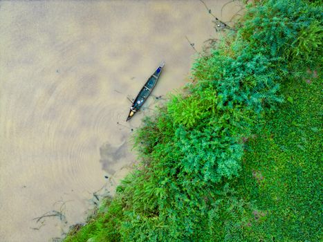
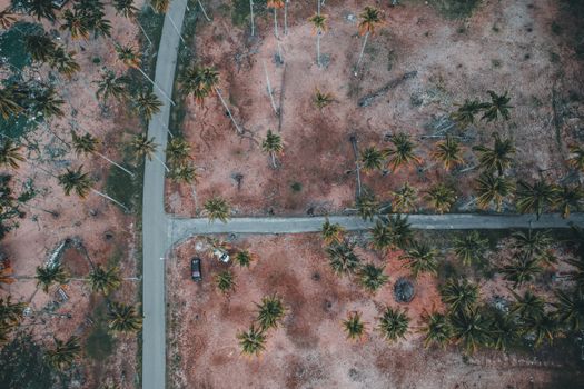
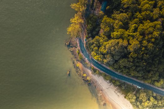
The wind whipped around me, threatening to snatch my drone right out of my hands. Below, the basalt columns of Reynisfjara stretched into the churning Atlantic, a dramatic, monochromatic canvas. I took a deep breath, launched my Mavic Pro, and watched it ascend, a tiny speck against the vast Icelandic sky. On my screen, the familiar black sand beach, the towering cliffs, and the relentless waves transformed. It wasn't just a photo anymore; it was an experience, a living, breathing landscape unfolding from a perspective I'd only ever dreamed of. That moment, years ago in Iceland, wasn't just my first truly "epic" drone shot; it was the moment I realized aerial photography wasn't just a hobby—it was a superpower.
But let's be honest, flying a drone as a traveler can feel like navigating a minefield of regulations, no-fly zones, and local sensitivities. I’ve been there, staring at a breathtaking vista, drone in hand, only to realize (after hours of research) that flying was either strictly forbidden or required a permit more complex than a visa application. It's frustrating, right? You want to capture that unique bird's-eye view, but you also want to be a responsible, law-abiding traveler.
That's why I've dedicated countless hours, and more than a few near-misses (ask me about the time a curious eagle took an interest in my drone in the Scottish Highlands!), to scouting out the dreamiest, most awe-inspiring locations where you can actually fly your drone legally and responsibly. These aren't just pretty places; they're places where the aerial perspective truly unlocks a new dimension of beauty.
So, pack your batteries, charge your controller, and get ready to elevate your travel photography. Here are 7 mind-blowing drone photography locations that allow flying, complete with my personal tips, anecdotes, and crucial practical advice.
1. Iceland: The Land of Fire and Ice, Unveiled from Above
If there’s one country that consistently delivers on drone photography potential, it’s Iceland. Its landscapes are so otherworldly, so vast, that they almost beg for an aerial perspective. From black sand beaches to glacial lagoons, geothermal fields to epic waterfalls, Iceland is a drone pilot's paradise.
Why it blows your mind:
Imagine the geometric patterns of braided rivers flowing across vast plains, the steam rising from geothermal vents creating ethereal mist, or the sheer scale of a glacier from a vantage point only a drone can offer. My most memorable shot was over the Jökulsárlón Glacier Lagoon, where icebergs the size of small houses drifted silently. From the ground, it was stunning. From 200 feet up, the sheer number of ice formations and the deep blue of the water created a mosaic I’ll never forget.
Where to fly (and where not to):
* Go-to spots: Reynisfjara Black Sand Beach (be mindful of the sneaker waves and tourists), the areas around Vík, the vast plains along the South Coast, Diamond Beach (Jökulsárlón), and much of the highlands (with caution and respect for nature).
* Be aware: National parks (like Vatnajökull, Snæfellsjökull, Þingvellir) are generally no-fly zones. Many popular tourist attractions (e.g., Seljalandsfoss, Skógafoss, Geysir) also have strict drone bans, often clearly signposted. ALWAYS check local signs and the Icelandic Transport Authority (ICETRA) regulations.
* Permits/Regulations: For recreational use, you generally don't need a specific permit if you follow the rules: stay below 120m (400ft), maintain visual line of sight, don't fly over people, respect privacy, and avoid airports/restricted airspace. Commercial use has stricter requirements.
* Best time to fly: During the shoulder seasons (spring/autumn) for fewer crowds and dramatic light. Summer offers endless daylight, while winter can bring incredible snowscapes (but also harsh winds and cold, which drain batteries faster).
My Pro Tip:
Iceland’s weather is notoriously fickle. Always check the wind forecast using apps like Windy or UAV Forecast. A calm morning can turn into a gale in minutes. I learned this the hard way when my drone was nearly swept into a waterfall. Always have a backup plan for landing!
2. The Faroe Islands: Dramatic Cliffs and Untamed Beauty
Nestled in the North Atlantic, the Faroe Islands are a hidden gem, a collection of 18 volcanic islands with breathtaking fjords, grass-roofed houses, and an abundance of sheep. This place feels like the edge of the world, and from above, it’s even more spectacular.
Why it blows your mind:
Imagine cliffs plunging hundreds of feet into turquoise waters, the famous "floating lake" (Sørvágsvatn/Leitisvatn) creating an optical illusion, or tiny villages dwarfed by majestic mountains. The sheer drama of the landscape is unparalleled. I once flew near the village of Gasadalur, capturing the iconic Múlafossur waterfall cascading directly into the ocean. The perspective from above, looking down into the churning water where the waterfall met the sea, was absolutely mesmerizing. It felt like I was witnessing a secret symphony of nature.
Where to fly (and where not to):
* Go-to spots: Gasadalur (Múlafossur waterfall), Saksun (iconic fjord village), Tjørnuvík (black sand beach with "Risin og Kellingin" sea stacks), and many of the uninhabited areas and coastal paths.
* Be aware: Regulations are becoming stricter, especially around popular tourist spots and nature reserves. Some areas, like the famous hike to Trælanípa (the floating lake), now require special permits or outright prohibit drones to protect nature and ensure visitor safety. Always look for signage. Flying near airports (Vágar Airport) is strictly forbidden.
* Permits/Regulations: The Faroese Civil Aviation Administration (FCAA) governs drone use. Recreational flying is generally permitted below 120m (400ft) and within visual line of sight, away from people and private property. However, for specific popular hiking trails or nature sites, landowners or local authorities may require a permit or prohibit flying. It's essential to check with the local tourist information centers or website (visitfaroeislands.com) for the latest updates.
* Best time to fly: Summer (June-August) for the mildest weather and longest daylight. However, the shoulder seasons (May, September) can offer dramatic light and fewer crowds. Be prepared for fog and rain at any time!
My Pro Tip:
The Faroes are incredibly windy. Seriously, incredibly windy. Invest in a good wind meter and only fly if the conditions are well within your drone's limits. I’ve seen drones struggle against gusts that felt like they could lift a small car. Also, respect the sheep; they are everywhere and easily startled!
3. Scottish Highlands: Mystical Moors and Ancient Castles
Scotland's Highlands are a land of myths and legends, of ancient castles, shimmering lochs, and vast, untamed wilderness. The moody skies and dramatic landscapes are a dream for any photographer, and drones add an entirely new layer to their mystical allure.
Why it blows your mind:
Imagine flying over the Isle of Skye's Old Man of Storr, revealing the jagged peaks and verdant valleys in their full glory, or soaring above a remote loch, capturing the perfect reflection of a centuries-old castle. I’ll never forget the feeling of launching my drone near Eilean Donan Castle, watching it rise above the mist, the ancient stone structure emerging from the ethereal fog like something out of a fairy tale. The drone allowed me to frame it perfectly against the dramatic backdrop of the surrounding mountains and lochs.
Where to fly (and where not to):
* Go-to spots: Isle of Skye (Quiraing, Old Man of Storr, Fairy Pools - check local signage), Glencoe (Glen Etive, Buachaille Etive Mòr), Loch Ness (away from populated areas), and many of the vast, open moorlands.
* Be aware: The UK has relatively strict drone laws enforced by the Civil Aviation Authority (CAA). You must register as an operator and pass a basic online test. National Parks (Cairngorms, Loch Lomond & The Trossachs) often have specific by-laws restricting or prohibiting drone use in certain areas. Flying over private property without permission is illegal. Many popular tourist sites (e.g., Edinburgh Castle, Urquhart Castle) are no-fly zones. Always check for local signs and airspace restrictions.
* Permits/Regulations: You need to register with the CAA as an operator (cost is minimal) and pass a free online test to get a Flyer ID. The primary rules for recreational flying are: stay below 120m (400ft), keep your drone in visual line of sight, don't fly over people, and maintain a safe distance from crowds, buildings, and vehicles. Always check the Drone Code and use an app like NATS Drone Assist for airspace information.
* Best time to fly: Spring and autumn offer incredible light, fewer midges (a blessing!), and vibrant colors. Summer can be busy, but the long daylight hours are a bonus. Winter is beautiful but can be very cold and wet.
My Pro Tip:
The midges in Scotland are legendary (and not in a good way!). If you're flying in summer, launch and retrieve your drone quickly, and wear midge repellent. Also, always remember that much of Scotland is privately owned. While you can often fly over open land, be mindful of privacy and livestock. A friendly chat with a local farmer can go a long way.
4. The Dolomites, Italy: Alpine Majesty from the Sky
The jagged, iconic peaks of the Dolomites, a UNESCO World Heritage site in northern Italy, are a photographer's dream. Their unique rock formations, emerald lakes, and alpine meadows are stunning from any angle, but a drone truly captures their monumental scale and intricate beauty.
Why it blows your mind:
Picture soaring above Tre Cime di Lavaredo, revealing the dramatic spires from an entirely new angle, or capturing the vibrant turquoise of Lago di Braies (Pragser Wildsee) nestled among the mountains. I remember flying my drone over Seceda at sunset, watching the golden light bathe the iconic ridgeline. The drone’s perspective allowed me to show the sheer drop-offs and the vastness of the valley below, creating a shot that truly conveyed the grandeur of the Alps.
Where to fly (and where not to):
* Go-to spots: Seceda, Tre Cime di Lavaredo (from designated areas), Lago di Braies (check local signs, as it's very popular), Alpe di Siusi (Europe's largest high-altitude alpine meadow), and many of the valleys and mountain passes.
* Be aware: Italy falls under EASA (European Union Aviation Safety Agency) regulations. This means you need to register as an operator in your country of residence (if an EU citizen) or in the first EU country you fly in. You'll also need to complete an online training course and pass an exam to get an "Open A1/A3" certificate. Many popular areas, especially around crowded lakes or within protected natural parks, may have local restrictions or bans. Always look for signage.
* Permits/Regulations: Key EASA rules for the "Open" category (recreational flying): maximum altitude 120m (400ft), maintain visual line of sight, do not fly over people (A3 subcategory, which most tourist drones fall under), and maintain appropriate distances from residential, commercial, industrial, and recreational areas. Check the D-Flight app for Italian airspace restrictions.
* Best time to fly: Late spring (June) and early autumn (September-October) are ideal. The wildflowers are in bloom in spring, and autumn brings spectacular golden larches. Summer is beautiful but can be very crowded.
My Pro Tip:
The weather in the mountains can change rapidly. Always check the forecast and be prepared for clouds to roll in quickly, obscuring your view and making drone navigation difficult. Also, be mindful of hikers and mountain huts; always prioritize their safety and privacy.
5. Moab, Utah (Outside National Parks): Red Rock Wonderland**
While US National Parks are famously (and strictly) no-drone zones, the vast public lands surrounding places like Moab, Utah, offer an unparalleled playground for drone pilots. The red rock landscapes, towering mesas, and winding canyons are nothing short of spectacular when seen from above.
Why it blows your mind:
Imagine your drone tracing the intricate curves of a canyon, revealing hidden arches, or showcasing the sheer scale of the desert landscape against a vibrant blue sky. My most unforgettable flight was over a lesser-known set of mesas near Canyonlands National Park. The drone climbed, and suddenly, the entire intricate network of canyons, the distant La Sal Mountains, and the winding Colorado River unfurled beneath me. It was like seeing the Earth’s geology laid bare, a masterpiece of erosion and time.
Where to fly (and where not to):
* Go-to spots: Much of the Bureau of Land Management (BLM) land surrounding Moab is open for drone use. Iconic areas like Fisher Towers, Corona Arch (ensure you're not flying over people), and various scenic byways offer incredible opportunities.
* Be aware: Absolutely NO flying within Arches National Park, Canyonlands National Park, or Dead Horse Point State Park. These are strictly enforced no-fly zones, and rangers will fine you. Always check land ownership before flying. Private property is also off-limits without permission.
* Permits/Regulations: As per FAA (Federal Aviation Administration) regulations in the US: recreational flyers must pass The Recreational UAS Safety Test (TRUST) and carry proof of passage. You must register your drone with the FAA if it weighs over 0.55 lbs (250 grams). Fly below 400 feet, keep your drone in visual line of sight, and don't fly over people. Use an app like B4UFLY to check for temporary flight restrictions (TFRs) and controlled airspace.
* Best time to fly: Spring (March-May) and Fall (September-November) offer pleasant temperatures and stunning light. Summer can be brutally hot, making battery life a concern, and winter can bring snow, which is beautiful but cold.
My Pro Tip:
The desert environment can be harsh on drones. Dust and sand can get into motors, and extreme heat can affect battery performance. Always clean your drone thoroughly after flights and keep spare batteries out of direct sunlight. Also, be mindful of the vastness; it’s easy to lose visual line of sight, so set your return-to-home point carefully!
6. Cape Town & Western Cape, South Africa: Coastal Grandeur and Mountain Views
Cape Town, with its iconic Table Mountain, dramatic coastlines, and diverse landscapes, offers an incredible array of drone photography opportunities. While Table Mountain itself is a no-fly zone, the surrounding Western Cape region provides endless vistas that are perfect for aerial capture.
Why it blows your mind:
Imagine your drone soaring above the Twelve Apostles mountain range, revealing hidden coves and pristine beaches, or capturing the vibrant colors of Bo-Kaap from a unique angle. My favorite flight here was along Chapman's Peak Drive, a winding coastal road carved into the mountainside. From above, the road snaked like a ribbon between the towering cliffs and the crashing Atlantic waves, creating a truly cinematic view that no ground shot could ever replicate. The scale and drama were breathtaking.
Where to fly (and where not to):
* Go-to spots: Chapman's Peak Drive (with caution, away from cars), the beaches of Clifton and Camps Bay (early morning for fewer people), the vineyards of Stellenbosch and Franschhoek (with permission from estates), and various coastal areas outside of national parks.
* Be aware: South Africa has strict drone regulations enforced by the South African Civil Aviation Authority (SACAA). Table Mountain National Park is a strict no-fly zone. You cannot fly over private property without permission, over people, or within 50 meters of roads. Flying within 10km of an airport is also prohibited without special authorization.
* Permits/Regulations: For recreational use, you generally need to adhere to these rules: fly below 120m (400ft), maintain visual line of sight, do not fly over people, public roads, or private property without permission. Always respect privacy. While a formal permit isn't usually required for recreational users following these rules, commercial operators need a Remote Pilot License (RPL) and an Air Service Certificate (ASC). Always check the latest SACAA regulations.
* Best time to fly: The summer months (November-February) offer long, sunny days, but can be windy. Spring (September-October) and autumn (March-April) offer milder weather and beautiful light.
My Pro Tip:
Cape Town is known for its "Cape Doctor" wind. Always check the wind speed before flying, especially near the coast or mountains. Gusts can appear suddenly and make flying incredibly challenging. Also, be mindful of wildlife, particularly birds of prey along the coast.
7. Lofoten Islands, Norway: Arctic Fjords and Fishing Villages (with careful planning)
The Lofoten Islands in Norway are a postcard-perfect archipelago, famous for their dramatic fjords, red fishing huts (rorbuer), and towering, snow-capped peaks. While Norway has quite strict drone laws, with careful planning and adherence to regulations, Lofoten offers some of the most stunning aerial photography opportunities on Earth.
Why it blows your mind:
Imagine your drone soaring above Reine, revealing the iconic village nestled amongst the mountains and pristine waters, or capturing the intricate patterns of a snow-dusted peak from a perspective that highlights its raw, untamed beauty. I remember flying my drone over Hamnøy, watching the red rorbuer pop against the deep blue of the fjord and the snow-dusted mountains. The drone truly captured the essence of "Arctic paradise," revealing the harmony between human settlement and dramatic nature.
Where to fly (and where not to):
* Go-to spots: Many of the open areas around villages like Reine, Hamnøy, and Nusfjord (check for local signs). The vast, uninhabited stretches of coastline and mountain areas (away from designated protected zones).
* Be aware: Norway, like other EASA countries, requires registration and an "Open A1/A3" certificate for recreational flyers. Crucially, many popular hiking trails and nature reserves in Lofoten have explicit drone bans to protect wildlife (especially nesting birds) and ensure visitor safety. These are often clearly signposted. Flying close to airports (e.g., Leknes, Svolvær) is strictly prohibited. Always check the Norwegian Civil Aviation Authority (Luftfartstilsynet) website and use the Droneguide app.
* Permits/Regulations: EASA rules apply (as mentioned for Italy): registration, online test, max 120m (400ft), visual line of sight, no flying over people (A3 subcategory). The "Droneguide" app is essential for checking local no-fly zones and restrictions. Always respect privacy and local wildlife.
* Best time to fly: Summer (June-August) for the Midnight Sun and lush green landscapes. Winter (November-March) for incredible snowscapes and potentially the Northern Lights (though flying in extreme cold is challenging). Shoulder seasons offer fewer crowds.
My Pro Tip:
Lofoten’s weather can be extremely unpredictable. Strong winds are common, and rain or snow can appear out of nowhere. Always be prepared for rapid changes. Battery life in cold weather is significantly reduced, so keep spare batteries warm. And once again, always, always check for local signage – it’s your best friend for legal and responsible flying.
---
Essential Drone Photography Tips for Responsible Travelers
Beyond the specific locations, here are some universal tips I’ve learned the hard way (so you don’t have to!) to ensure your drone adventures are safe, legal, and truly epic.
- Know the Law (Before You Go!): This is non-negotiable. Drone laws vary wildly from country to country, and even within regions or specific parks. Before booking your trip, research the local Civil Aviation Authority (CAA) website for your destination. Look for terms like "UAS" (Unmanned Aircraft System) or "RPAS" (Remotely Piloted Aircraft System) regulations. Apps like AirMap, B4UFLY (US), Droneguide (EU), or specific local apps are invaluable.
- Respect Privacy & People: Your drone is a camera, and flying it over people or private property without permission is not only often illegal but also incredibly intrusive. Always maintain a safe distance from individuals and crowds. Ask for permission if you’re flying near a local community, especially in culturally sensitive areas.
- Stay Away from Wildlife: Drones can stress or harm animals. Never harass wildlife with your drone. Maintain a respectful distance, especially from nesting birds, marine mammals, or herds of animals. If you see animals reacting to your drone, land immediately.
- Weather is King: Wind, rain, fog, and extreme temperatures are your drone's worst enemies. Always check the forecast before flying. Cold weather significantly reduces battery life, and high winds can make your drone uncontrollable. I’ve had my drone caught in an unexpected gust over a fjord – not a fun experience!
- Pre-Flight Checklist: Develop a routine. Check your propellers, battery levels (drone and controller), GPS signal, camera settings, and ensure your landing area is clear. A quick visual inspection can prevent costly crashes.
- ND Filters are Your Friend: Neutral Density (ND) filters are like sunglasses for your drone's camera. They reduce the amount of light entering the lens, allowing for slower shutter speeds and more cinematic, motion-blurred footage, especially in bright conditions.
- Master Your Settings: Don't just hit "auto." Learn about ISO, shutter speed, aperture, and white balance. Experiment with shooting in RAW for photos and a flat color profile (like D-Log or Cine-D) for video to give you more flexibility in post-processing.
- Battery Management: Cold weather drains batteries faster. In remote locations, power banks for your controller and intelligent flight batteries are crucial. Always carry more batteries than you think you'll need.
- Visual Line of Sight (VLOS): Most regulations require you to keep your drone in sight at all times. This isn't just a rule; it's a safety measure. Losing VLOS can lead to disorientation and potential crashes.
- Get Insurance: Accidents happen. Drone insurance can cover damage to your drone, third-party liability, and even theft. It's a small investment for peace of mind.
---
Conclusion: Elevate Your Perspective, Responsibly
The world is a magnificent tapestry, and from the unique vantage point of a drone, you can capture its beauty in ways previously unimaginable. These seven locations are just a starting point, but they represent some of the most breathtaking and (crucially) legally accessible places to unleash your aerial creativity.
Remember, with great power comes great responsibility. Be a thoughtful, respectful, and law-abiding drone pilot. Do your homework, prioritize safety, and always put the environment and local communities first. When you do, you'll not only capture incredible images but also contribute to a positive perception of drone pilots worldwide.
So, what are you waiting for? Charge those batteries, pack your bags, and get ready to see the world from a truly mind-blowing perspective.
Which of these drone locations are you adding to your bucket list? Or do you have another incredible, legal spot to share? Drop a comment below and let's inspire each other to capture the world from above!
---